Hotspots H2o
USGS Water Mapping Tool
- Autor: Vários
- Narrador: Vários
- Editor: Podcast
- Duración: 0:04:35
- Mas informaciones
Informações:
Sinopsis
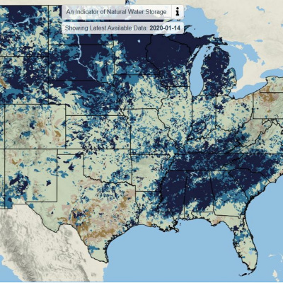
This week, from Circle of Blue, technology is offering answers to the ageless question: Where is the water? A new mapping tool from the U.S. federal government’s top Earth sciences agency aims to visualize the nations’s water resources with greater frequency and detail. The map displays a nearly complete picture of water storage in the Lower 48 states. It’s updated daily, and shows water currently held in snowpack, soils, and shallow groundwater as compared to the long-term average. This Circle of Blue featured excerpt comes from the 1/20/2020 episode of What's Up With Water.